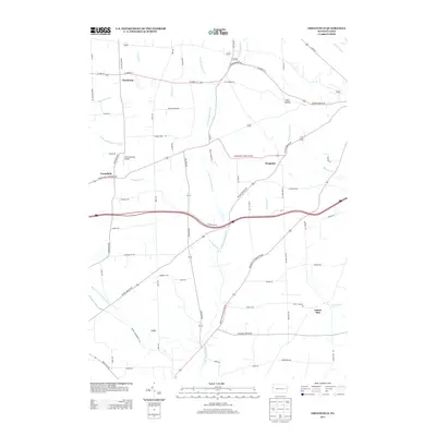
2013 Map of Greenfield
USGS Topo · Published 2013About this map
Charleston and Greenfield anchor the landscape of this western Pennsylvania corridor, where a dense network of country roads connects historic crossroads settlements. The terrain is defined by the dendritic drainage of the Little Neshannock Cr and its tributaries, such as Harthegig Run and the W Br Little Neshannock Cr. A mix of small-scale aviation and rural industry is evident at Lackawannock Airport, while the nomenclature of the land is preserved in distinctive local names like Hells Hollow. To the southeast, the small hamlet of Indian Run sits near its namesake waterway, illustrating the enduring relationship between early 19th-century settlement patterns and the region's stream valleys. The presence of Hoagland and Lyle further emphasizes the dispersed agricultural nature of the county, bridged by long-established thoroughfares like Sharon Mercer Rd and Pulaski Mercer Rd.
Find a feature on this map
71 named features on this map. Tap any name to fly to it.
Don’t see what you’re looking for? This feature index may not catch every label — zoom into the map to look around manually.
Map Details
Editions of this 2013 Greenfield Map
This is the sole edition of this map. No revisions or reprints were ever made.
Other maps of this area

1905 · Neshannock
USGS Topo · 1:62,500

1907 · Neshannock
USGS Topo · 1:62,500

1908 · Shenango
USGS Topo · 1:62,500

1911 · Stoneboro
USGS Topo · 1:62,500

1913 · Stoneboro
USGS Topo · 1:62,500

1913 · Mercer
USGS Topo · 1:62,500

1939 · Mercer
USGS Topo · 1:62,500

1943 · Mercer
USGS Topo · 1:62,500

1943 · Stoneboro
USGS Topo · 1:62,500

1950 · Cleveland
USGS Topo · 1:250,000
Featured Places
- New Wilmington, PA
- Jefferson Township, PA
- Wilmington Township, PA
- Greenfield, Lackawannock Township
- Lackawannock Township, PA