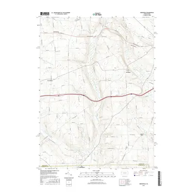
2016 Map of Greenfield
USGS Topo · Published 2016About this map
Little Neshannock Creek serves as the primary drainage for this agricultural and woodland landscape straddling the border of Mercer and Lawrence Counties. The terrain is defined by a network of smaller tributaries including Harthegig Run and Magargee Run, which carve out local features such as the descriptively named Hells Hollow in the northeast. Small, historic settlements like Greenfield, Hoagland, and Charleston are scattered throughout, connected by a dense grid of township roads. Genealogists and local historians will find value in the preservation of several community burial grounds, including Zahniser Cem and White Chapel Cem, which anchor the rural landscape. At the southern edge of the survey, the northern outskirts of New Wilmington appear, signaling a transition from the rolling farms toward more established town centers.
Find a feature on this map
84 named features on this map. Tap any name to fly to it.
Don’t see what you’re looking for? This feature index may not catch every label — zoom into the map to look around manually.
Map Details
Editions of this 2016 Greenfield Map
This is the sole edition of this map. No revisions or reprints were ever made.
Other maps of this area

1905 · Neshannock
USGS Topo · 1:62,500

1907 · Neshannock
USGS Topo · 1:62,500

1908 · Shenango
USGS Topo · 1:62,500

1911 · Stoneboro
USGS Topo · 1:62,500

1913 · Stoneboro
USGS Topo · 1:62,500

1913 · Mercer
USGS Topo · 1:62,500

1939 · Mercer
USGS Topo · 1:62,500

1943 · Mercer
USGS Topo · 1:62,500

1943 · Stoneboro
USGS Topo · 1:62,500

1950 · Cleveland
USGS Topo · 1:250,000
Featured Places
- New Wilmington, PA
- Jefferson Township, PA
- Wilmington Township, PA
- Greenfield, Lackawannock Township
- Lackawannock Township, PA