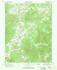
1967 Map of Greenfield
USGS Topo · Published 1970About this map
Greenfield and the North Fork Rockfish River valley define this 1967 survey of the Blue Ridge foothills on the boundary of Albemarle and Nelson counties. The landscape is dotted with small rural settlements and religious centers, including Hebron Ch, Rodes Ch, and the Holy Cross Ch further east. The eastern edge of the George Washington National Forest borders the valley, where several family-named hollows like Cooks Hollow and Blundell Hollow descend toward the river. To the south, Nellysford and Lodebar sit near the confluence of the Rockfish Valley Creek and the South Fork Rockfish River. The terrain is characterized by prominent peaks like Ennis Mtn and Pilot Mtn, while the presence of Camp Monocan near Allen Creek suggests the area's development for recreational use by the late 1960s.
Find a feature on this map
52 named features on this map. Tap any name to fly to it.
Don’t see what you’re looking for? This feature index may not catch every label — zoom into the map to look around manually.
Map Details
Editions of this 1967 Greenfield Map
Other maps of this area

1892 · Buckingham
USGS Topo · 1:125,000

1892 · Harrisonburg
USGS Topo · 1:125,000

1929 · Covesville
USGS Topo · 1:62,500

1931 · University
USGS Topo · 1:62,500

1934 · Waynesboro
USGS Topo · 1:48,000

1935 · Covesville
USGS Topo · 1:62,500

1935 · University
USGS Topo · 1:62,500

1939 · Waynesboro
USGS Topo · 1:62,500

1943 · Lovingston
USGS Topo · 1:62,500

1945 · Covesville
USGS Topo · 1:62,500