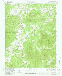
1967 Map of Greenfield
USGS Topo · Published 1981About this map
Rockfish Valley Creek and the South Fork Rockfish River define the valley floor where agriculture and community life centered in the late 1960s. The settlement pattern is anchored by small crossroads and named locales such as Greenfield, Durrett Town, and Nellysford. This area exhibits a high density of rural religious centers, including Hebron Ch, Union Ch, and Rodes Ch in the northern reaches, while the Rockfish Valley Sch serves as a central landmark for local families.
Find a feature on this map
46 named features on this map. Tap any name to fly to it.
Don’t see what you’re looking for? This feature index may not catch every label — zoom into the map to look around manually.
Map Details
Editions of this 1967 Greenfield Map
Other maps of this area

1892 · Buckingham
USGS Topo · 1:125,000

1892 · Harrisonburg
USGS Topo · 1:125,000

1929 · Covesville
USGS Topo · 1:62,500

1931 · University
USGS Topo · 1:62,500

1934 · Waynesboro
USGS Topo · 1:48,000

1935 · Covesville
USGS Topo · 1:62,500

1935 · University
USGS Topo · 1:62,500

1939 · Waynesboro
USGS Topo · 1:62,500

1943 · Lovingston
USGS Topo · 1:62,500

1945 · Covesville
USGS Topo · 1:62,500