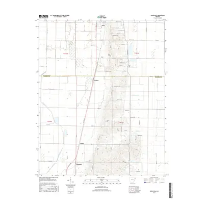
2017 Map of Greenfield
USGS Topo · Published 2017About this map
Greenfield and Mulligan anchor this agricultural and topographic landscape south of Jonesboro, where the delta flats meet the rising elevation of Mount Pisgah. This region is defined by the transition from the low-lying drainage of the L'Anguille River and Ganaway Cr to the higher ground marked by Ridge and Cary. The map reveals a high density of rural burial sites, including Mount Pisgah Cem, White Cem, Houston Cem, Willis Cem, and Wilson Cem, which suggest long-standing family settlements and community centers throughout Craighead and Poinsett Counties. A complex network of roads like Old Military Ln and Punkin Center Rd connects these small locales, tracing a settlement pattern heavily influenced by the distinct change in terrain between the river bottomlands and the elevated ridges.
Find a feature on this map
78 named features on this map. Tap any name to fly to it.
Don’t see what you’re looking for? This feature index may not catch every label — zoom into the map to look around manually.
Map Details
Editions of this 2017 Greenfield Map
This is the sole edition of this map. No revisions or reprints were ever made.
Other maps of this area

1935 · Sedgwick
USGS Topo · 1:62,500

1939 · Weiner
USGS Topo · 1:62,500

1939 · Jonesboro
USGS Topo · 1:62,500

1940 · Dee
USGS Topo · 1:62,500

1953 · Memphis
USGS Topo · 1:250,000

1956 · Memphis
USGS Topo · 1:250,000

1958 · Dee
USGS Topo · 1:62,500

1958 · Jonesboro
USGS Topo · 1:62,500

1959 · Weiner
USGS Topo · 1:62,500

1959 · Sedgwick
USGS Topo · 1:62,500