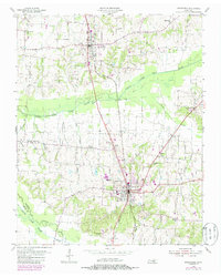
1954 Map of Greenfield
USGS Topo · Published 1985About this map
Sharon and Greenfield serve as the primary population centers on this West Tennessee landscape, anchored by the Illinois Central Gulf rail line that runs north-south through the region. The agricultural and hydraulic character of the area is defined by the Middle Fork Obion River and the South Fork Obion River, where complex drainage features like the Wing Ditch and Ditch illustrate efforts to manage the river bottomlands. Numerous family-named cemeteries and rural congregations, such as Kimery Cem and Brocks Chapel, are scattered throughout the countryside, marking the long-established social fabric of the rural townships. The map also records the Gibson Co Weakley Co boundary line, showing the intersection of political divisions with natural watercourses like Spring Creek.
Find a feature on this map
39 named features on this map. Tap any name to fly to it.
Don’t see what you’re looking for? This feature index may not catch every label — zoom into the map to look around manually.
Map Details
Editions of this 1954 Greenfield Map
3 editions found
Other maps of this area

1950 · Martin
USGS Topo · 1:24,000

1952 · Dresden
USGS Topo · 1:24,000

1953 · Dyer
USGS Topo · 1:24,000

1954 · Rutherford
USGS Topo · 1:24,000

1954 · Greenfield
USGS Topo · 1:24,000

1954 · Bradford
USGS Topo · 1:24,000

1956 · Gardner
USGS Topo · 1:24,000

1956 · Dyersburg
USGS Topo · 1:250,000

1966 · Trezevant West
USGS Topo · 1:24,000

1967 · Pillowville
USGS Topo · 1:24,000