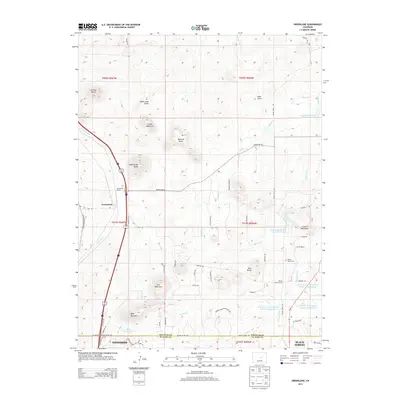
2013 Map of Greenland
USGS Topo · Published 2013About this map
Greenland Ranch and the nearby settlement of Greenland sit along the western edge of this landscape, where the high plains meet the prominent buttes and gulches of the Palmer Divide. This 2013 survey illustrates the modern configuration of rural properties and expanding residential areas like Woodmoor and Black Forest along the southern border. The map is particularly useful for genealogists and local historians, capturing the Spring Valley School and Spring Valley Cem in the eastern section near W Cherry Cr. The terrain is defined by a series of named elevations including True Mountain, Larkspur Butte, and Rattlesnake Butte, which overlook a complex network of water management features such as the W Cherry Cr Detention Number 7 Reservoir and Allis Reservoir. This mix of ranching heritage and modern water infrastructure characterizes the region’s development in the early 21st century.
Find a feature on this map
66 named features on this map. Tap any name to fly to it.
Don’t see what you’re looking for? This feature index may not catch every label — zoom into the map to look around manually.
Map Details
Editions of this 2013 Greenland Map
This is the sole edition of this map. No revisions or reprints were ever made.
Other maps of this area

1894 · Castle Rock
USGS Topo · 1:125,000

1913 · Castle Rock
USGS Topo · 1:125,000

1939 · Elizabeth
USGS Topo · 1:62,500

1940 · Elbert
USGS Topo · 1:62,500

1940 · Castle Rock
USGS Topo · 1:62,500

1944 · Elbert
USGS Topo · 1:62,500

1945 · Castle Rock
USGS Topo · 1:62,500

1945 · Elizabeth
USGS Topo · 1:62,500

1953 · Denver
USGS Topo · 1:250,000

1954 · Cherry Valley School
USGS Topo · 1:24,000