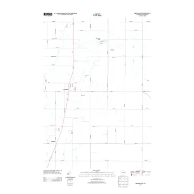
2013 Map of Greenleaf
USGS Topo · Published 2013About this map
Greenleaf stands as a primary focal point of this Brown County landscape, situated where the E River and several local transit corridors meet. The area is characterized by its agricultural heritage and aviation infrastructure, featuring several named agricultural properties like East Creek Farm, Wobeck Farm, and Heatherbrook Farm. Private aviation is notably present through the Birch Creek Airport and the C. R. Acres Airport, reflecting a specific pattern of land use where large rural holdings integrated their own airstrips. To the south, the community of Askeaton provides another anchor for local history researchers. The drainage patterns of the E River and the Br River dictate much of the surrounding terrain, while recreation is represented by the Hilly Haven Golf Course. The network of roads, including Old Military Rd and Wrightstown Rd, highlights the historical transit routes connecting these rural Wisconsin settlements.
Find a feature on this map
55 named features on this map. Tap any name to fly to it.
Don’t see what you’re looking for? This feature index may not catch every label — zoom into the map to look around manually.
Map Details
Editions of this 2013 Greenleaf Map
This is the sole edition of this map. No revisions or reprints were ever made.
Other maps of this area

1954 · De Pere
USGS Topo · 1:62,500

1954 · Denmark
USGS Topo · 1:62,500

1954 · De Pere
USGS Topo · 1:24,000

1954 · Chilton
USGS Topo · 1:62,500

1954 · Reedsville
USGS Topo · 1:62,500

1954 · Manitowoc
USGS Topo · 1:250,000

1954 · Bellevue
USGS Topo · 1:24,000

1955 · Green Bay
USGS Topo · 1:250,000

1958 · Manitowoc
USGS Topo · 1:250,000

1974 · Hilbert
USGS Topo · 1:24,000