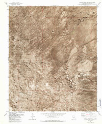
1981 Map of Greens Baber Well
USGS Topo · Published 1987About this map
The White Sands Missile Range dominates this landscape in Socorro County, showing a sparse desert geography defined by specialized infrastructure and remote outposts. This orthophotomosaic, based on 1971 aerial photography, provides a rare look at the functional layout of the range during the early 1980s. Water sources, vital for operations and earlier ranching history, appear as isolated points like Baber Well, Story Well, and Green Tank.
Find a feature on this map
29 named features on this map. Tap any name to fly to it.
Don’t see what you’re looking for? This feature index may not catch every label — zoom into the map to look around manually.
Map Details
Editions of this 1981 Greens Baber Well Map
2 editions found
Other maps of this area

1918 · Oscura Peak
USGS Topo · 1:125,000

1948 · Carthage
USGS Topo · 1:62,500

1948 · Granjean Well
USGS Topo · 1:62,500

1948 · Bingham
USGS Topo · 1:62,500

1948 · Mockingbird Gap
USGS Topo · 1:62,500

1954 · Tularosa
USGS Topo · 1:250,000

1958 · Tularosa
USGS Topo · 1:250,000
1981 · Greens Baber Well
USGS Topo · 1:24,000

1981 · Granjean Well
USGS Topo · 1:24,000
1981 · Foster Well
USGS Topo · 1:24,000