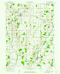
1960 Map of Greens Fork
USGS Topo · Published 1961About this map
Agricultural life in central Wayne County is organized around the headwaters of several key waterways, including the Whitewater River and the meandering Greens Fork. Small rural hubs such as Economy and Williamsburg serve as anchors for the surrounding farmsteads, which are connected by a dense grid of local roads like Jacksonburg Road and Smoky Row Road. The landscape is dotted with several houses of worship, such as Sugar Grove Ch and Salem Ch, and community burial grounds including Fairfield Cem.
Find a feature on this map
49 named features on this map. Tap any name to fly to it.
Don’t see what you’re looking for? This feature index may not catch every label — zoom into the map to look around manually.
Map Details
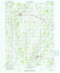
Editions of this 1960 Greens Fork Map
2 editions found
Other maps of this area

1915 · New Paris
USGS Topo · 1:48,000

1916 · Winchester
USGS Topo · 1:48,000

1918 · Winchester
USGS Topo · 1:62,500

1918 · New Paris
USGS Topo · 1:62,500

1943 · Winchester
USGS Topo · 1:62,500

1953 · Cincinnati
USGS Topo · 1:250,000

1953 · Muncie
USGS Topo · 1:250,000

1956 · Muncie
USGS Topo · 1:250,000

1957 · Cincinnati
USGS Topo · 1:250,000

1960 · Carlos
USGS Topo · 1:24,000