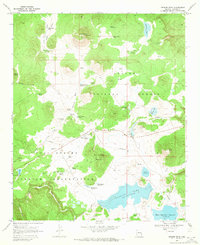
1969 Map of Greens Peak
USGS Topo · Published 1972About this map
Greens Peak dominates this high-country landscape at the intersection of the Apache National Forest and the Fort Apache Indian Reservation. In 1969, the peak was a hub of activity featuring a Lookout Tower and Radio Towers, while the surrounding terrain was defined by complex drainage systems like Udall Draw and Sherlock Draw. A network of water management features, including the Old Colter Ranch and Colter Ranch, suggests a history of livestock grazing in the area. High-altitude wetlands and basins are evident at Big Cienega Mountain and various stock tanks like Sherlock Draw Tank No 1. The map also captures recreation and resource sites such as Carnero Lake and a Cinder Pit, showing how this mountainous region was utilized for both infrastructure and rural ranching at the end of the 1960s.
Find a feature on this map
55 named features on this map. Tap any name to fly to it.
Don’t see what you’re looking for? This feature index may not catch every label — zoom into the map to look around manually.
Map Details
Editions of this 1969 Greens Peak Map
2 editions found
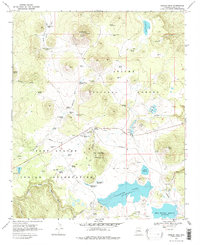
Other maps of this area

1886 · St Johns
USGS Topo · 1:250,000

1892 · St Johns
USGS Topo · 1:250,000

1922 · Nutrioso
USGS Topo · 1:125,000

1954 · Clifton
USGS Topo · 1:250,000

1954 · Saint Johns
USGS Topo · 1:250,000

1957 · Clifton
USGS Topo · 1:250,000

1957 · Saint Johns
USGS Topo · 1:250,000

1958 · Clifton
USGS Topo · 1:250,000

1958 · Saint Johns
USGS Topo · 1:250,000

1958 · Big Lake
USGS Topo · 1:62,500