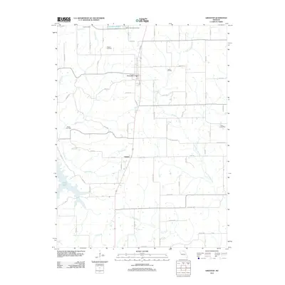
2012 Map of Greentop
USGS Topo · Published 2012About this map
Greentop sits at the heart of this North Missouri landscape, straddling the line between Adair and Schuyler counties during the early 21st century. The map reveals a region defined by managed water resources and a sparse, grid-based road network. Large reservoirs and infrastructure like the Public Water-Supply District 1 L Reservoir and Hazel Creek Lake dominate the hydrography, while smaller impoundments such as the Gregory Lake Dam and Robert Horn Dam dot the countryside. For genealogists and local historians, the sheet preserves the locations of Fugate Cemetery in the northwest and Towles Cemetery to the east. The southern portion of the quadrangle is largely defined by the winding course of the North Fork Salt River and the small community of Sublette, illustrating the rural character of the Missouri heartland.
Find a feature on this map
70 named features on this map. Tap any name to fly to it.
Don’t see what you’re looking for? This feature index may not catch every label — zoom into the map to look around manually.
Map Details
Editions of this 2012 Greentop Map
This is the sole edition of this map. No revisions or reprints were ever made.
Other maps of this area

1903 · Edina
USGS Topo · 1:125,000

1911 · Queen City
USGS Topo · 1:62,500

1913 · Queen City
USGS Topo · 1:62,500

1938 · Kirksville
USGS Topo · 1:62,500

1940 · Kirksville
USGS Topo · 1:62,500

1954 · Centerville
USGS Topo · 1:250,000

1957 · Centerville
USGS Topo · 1:250,000

1958 · Centerville
USGS Topo · 1:250,000

1965 · Downing NW
USGS Topo · 1:24,000

1966 · Brashear
USGS Topo · 1:24,000