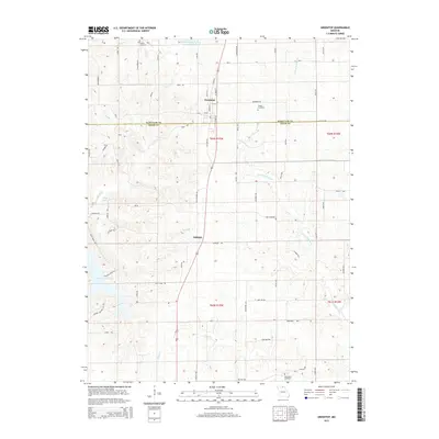
2015 Map of Greentop
USGS Topo · Published 2015About this map
Greentop and Sublette anchor this northern Missouri landscape, situated where the high ground between Hazel Cr and the N Fork Salt River serves as a corridor for travel. The area is defined by its transition from agricultural uplands to the dendritic drainage patterns of Buck Creek Br and Floyd Cr. Notable water management is evident at the Public Water Supply District 1 L Reservoir and the expansive Hazel Creek Lake in the southwest. Local history is preserved in several family and community burial grounds, including Fugate Cemetery, Towles Cemetery, and Oak Grove Cemetery, which provide vital touchpoints for genealogical research in this rural borderland between Schuyler and Adair counties. The map also identifies Fort Madison, a distinct landmark situated east of the primary north-south highway.
Find a feature on this map
77 named features on this map. Tap any name to fly to it.
Don’t see what you’re looking for? This feature index may not catch every label — zoom into the map to look around manually.
Map Details
Editions of this 2015 Greentop Map
This is the sole edition of this map. No revisions or reprints were ever made.
Other maps of this area

1903 · Edina
USGS Topo · 1:125,000

1911 · Queen City
USGS Topo · 1:62,500

1913 · Queen City
USGS Topo · 1:62,500

1938 · Kirksville
USGS Topo · 1:62,500

1940 · Kirksville
USGS Topo · 1:62,500

1954 · Centerville
USGS Topo · 1:250,000

1957 · Centerville
USGS Topo · 1:250,000

1958 · Centerville
USGS Topo · 1:250,000

1965 · Downing NW
USGS Topo · 1:24,000

1966 · Brashear
USGS Topo · 1:24,000