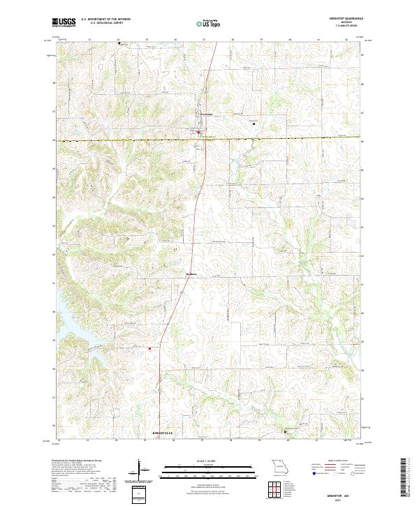
2021 Map of Greentop
USGS Topo · Published 2021About this map
The town of Greentop straddles the boundary between Schuyler County and Adair County in north-central Missouri. This landscape is defined by the drainage networks of the N Fork Salt River to the east and Little Hazel Creek to the southwest. The terrain is marked by numerous family-named roads and burial grounds, providing a detailed view of the rural settlement patterns that persist into the 21st century. Significant local landmarks include Fugate Cem and Towles Cem, which serve as permanent records of the area's early residents. The southern portion of the map includes the northern outskirts of Kirksville, showing the transition from agricultural land to more concentrated residential development. Smaller settlements like Sublette along the central corridor highlight the historical reliance on local road networks such as State Hwy K and Pleasant Grove Rd for regional connectivity.
Find a feature on this map
71 named features on this map. Tap any name to fly to it.
Don’t see what you’re looking for? This feature index may not catch every label — zoom into the map to look around manually.
Map Details
Editions of this 2021 Greentop Map
This is the sole edition of this map. No revisions or reprints were ever made.
Other maps of this area

1903 · Edina
USGS Topo · 1:125,000

1911 · Queen City
USGS Topo · 1:62,500

1913 · Queen City
USGS Topo · 1:62,500

1938 · Kirksville
USGS Topo · 1:62,500

1940 · Kirksville
USGS Topo · 1:62,500

1954 · Centerville
USGS Topo · 1:250,000

1957 · Centerville
USGS Topo · 1:250,000

1958 · Centerville
USGS Topo · 1:250,000

1965 · Downing NW
USGS Topo · 1:24,000

1966 · Brashear
USGS Topo · 1:24,000