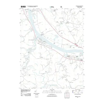
2011 Map of Greenup
USGS Topo · Published 2011About this map
The Ohio River carves through this borderland, where industrial heritage and family homesteads line the banks between Kentucky and Ohio. On the Kentucky side, the city of Greenup serves as a focal point, established near the confluence with the Little Sandy River. This area is dense with genealogical markers, from the Riverview Cemetery and Worthington Cemetery in town to the more remote Melvin Cemetery and Heaberlin Cemetery further south. The landscape is defined by a series of narrow valleys, such as California Hollow and Brickhouse Hollow, which cut into the rising terrain above the river plain.
Find a feature on this map
157 named features on this map. Tap any name to fly to it.
Don’t see what you’re looking for? This feature index may not catch every label — zoom into the map to look around manually.
Map Details
Editions of this 2011 Greenup Map
This is the sole edition of this map. No revisions or reprints were ever made.
Other maps of this area

1898 · Ironton
USGS Topo · 1:62,500

1900 · Ironton
USGS Topo · 1:62,500

1901 · Ceredo
USGS Topo · 1:62,500

1903 · Kenova
USGS Topo · 1:125,000

1904 · Kenova
USGS Topo · 1:125,000

1913 · Ceredo
USGS Topo · 1:62,500

1926 · Greenup
USGS Topo · 1:48,000

1930 · Greenup
USGS Topo · 1:62,500

1953 · Oldtown
USGS Topo · 1:24,000
1953 · Load
USGS Topo · 1:24,000