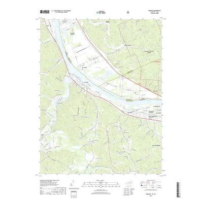
2019 Map of Greenup
USGS Topo · Published 2019About this map
Greenup sits along the southern bank of the Ohio River, serving as a central point of settlement in this Kentucky-Ohio border region. The landscape is defined by the sharp transition from the industrial and transport corridors of the river valley to the steep, wooded terrain of Wayne National Forest. To the north in Ohio, a series of historic furnace sites, including Franklin Furnace, Junior Furnace, and Ohio Furnace, indicate the area's deep-rooted industrial heritage.
Find a feature on this map
76 named features on this map. Tap any name to fly to it.
Don’t see what you’re looking for? This feature index may not catch every label — zoom into the map to look around manually.
Map Details
Editions of this 2019 Greenup Map
This is the sole edition of this map. No revisions or reprints were ever made.
Other maps of this area

1898 · Ironton
USGS Topo · 1:62,500

1900 · Ironton
USGS Topo · 1:62,500

1901 · Ceredo
USGS Topo · 1:62,500

1903 · Kenova
USGS Topo · 1:125,000

1904 · Kenova
USGS Topo · 1:125,000

1913 · Ceredo
USGS Topo · 1:62,500

1926 · Greenup
USGS Topo · 1:48,000

1930 · Greenup
USGS Topo · 1:62,500

1953 · Oldtown
USGS Topo · 1:24,000
1953 · Load
USGS Topo · 1:24,000