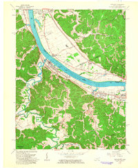
1961 Map of Greenup
USGS Topo · Published 1963About this map
The Ohio River acts as a busy corridor through this 1961 survey, bordered by the heavy industrial rail lines of the Chesapeake And Ohio and Norfolk And Western. The town of Greenup serves as a central hub, flanked by several smaller communities like Wurtland, Raceland Junction, and Haverhill. This era reveals a landscape transitioning from agricultural river bottoms to mid-century industrial development, evidenced by a Drive-in Theatre and the County Park and Fairgrounds.
Find a feature on this map
58 named features on this map. Tap any name to fly to it.
Don’t see what you’re looking for? This feature index may not catch every label — zoom into the map to look around manually.
Map Details
Editions of this 1961 Greenup Map
This is the sole edition of this map. No revisions or reprints were ever made.
Other maps of this area

1898 · Ironton
USGS Topo · 1:62,500

1900 · Ironton
USGS Topo · 1:62,500

1901 · Ceredo
USGS Topo · 1:62,500

1903 · Kenova
USGS Topo · 1:125,000

1904 · Kenova
USGS Topo · 1:125,000

1913 · Ceredo
USGS Topo · 1:62,500

1926 · Greenup
USGS Topo · 1:48,000

1930 · Greenup
USGS Topo · 1:62,500

1953 · Oldtown
USGS Topo · 1:24,000
1953 · Load
USGS Topo · 1:24,000