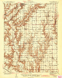
1943 Map of Greenup
USGS Topo · Published 1943About this map
Embarrass River meanders through the heart of the Cumberland and Jasper county borderlands, defining a landscape of deep drainage and small-scale agriculture during the early 1940s. The village of Greenup serves as a primary hub, situated at the intersection of the Pennsylvania Railroad and the Illinois Central lines. This rail-and-river network supported a dense grid of rural institutions, from the Universalist Ch and Bethany Ch to specialized local schoolhouses like Water Oak Sch and Baumgartner Sch. The map reveals a transition from the river bottomlands to the surrounding prairie uplands, where the density of cemeteries such as Washington Cem and Kibler Cem marks the long-settled family homesteads of the region. This 1943 edition reflects a moment before the widespread consolidation of rural schools and the reconfiguration of the local road network.
Find a feature on this map
94 named features on this map. Tap any name to fly to it.
Don’t see what you’re looking for? This feature index may not catch every label — zoom into the map to look around manually.
Map Details
Editions of this 1943 Greenup Map
2 editions found
Other maps of this area

1910 · Hardinville
USGS Topo · 1:62,500

1933 · Toledo
USGS Topo · 1:62,500

1934 · Mattoon
USGS Topo · 1:62,500

1936 · Casey
USGS Topo · 1:48,000

1937 · Mattoon
USGS Topo · 1:62,500

1938 · Toledo
USGS Topo · 1:62,500

1940 · Greenup
USGS Topo · 1:62,500

1941 · Newton
USGS Topo · 1:62,500

1942 · Casey
USGS Topo · 1:62,500

1943 · Greenup
USGS Topo · 1:62,500