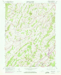
1964 Map of Greenville
USGS Topo · Published 1972About this map
Greenville and the surrounding Shenandoah Valley landscape appear here in a 1964 survey, capturing the region's agricultural and spiritual foundations. The map reveals a network of rural hubs anchored by historic churches and community centers like Middlebrook and Arbor Hill. This mid-century view highlights the essential infrastructure of the day, from the path of the Norfolk and Western Railroad to the establishment of Riverheads High Sch.
Find a feature on this map
30 named features on this map. Tap any name to fly to it.
Don’t see what you’re looking for? This feature index may not catch every label — zoom into the map to look around manually.
Map Details
Editions of this 1964 Greenville Map
Other maps of this area

1894 · Staunton
USGS Topo · 1:125,000

1894 · Lexington
USGS Topo · 1:125,000

1932 · Lexington
USGS Topo · 1:48,000

1936 · Vesuvius
USGS Topo · 1:48,000

1937 · Lexington
USGS Topo · 1:62,500

1941 · Vesuvius
USGS Topo · 1:62,500

1943 · Craigsville
USGS Topo · 1:62,500

1944 · Staunton
USGS Topo · 1:62,500

1945 · Craigsville
USGS Topo · 1:62,500

1947 · Staunton
USGS Topo · 1:62,500