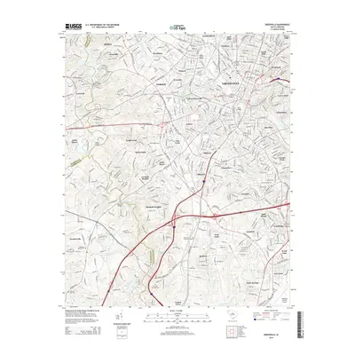
2014 Map of Greenville
USGS Topo · Published 2014About this map
The Greenville metropolitan landscape in the early 21st century is defined by the sharp convergence of multiple county lines and the winding course of the Saluda River. Neighborhoods and industrial corridors like Parker, Dunean, and Woodside reflect the area’s dense urban development, while the west is marked by the waters of Saluda Lake and the crossing at Saluda Dam Bridge. For those researching local history, the map provides precise locations for numerous community landmarks, including Springwood Cem and Christ Church Cem in the city center, and more peripheral sites like Bethesda Baptist Cem near Powdersville. The intersection of Pickens Co, Greenville Co, and Anderson Co underscores the regional connectivity of the area, anchored by the Reedy River and a network of named bridges and small water bodies such as Lakeside Lake.
Find a feature on this map
71 named features on this map. Tap any name to fly to it.
Don’t see what you’re looking for? This feature index may not catch every label — zoom into the map to look around manually.
Map Details
Editions of this 2014 Greenville Map
This is the sole edition of this map. No revisions or reprints were ever made.
Other maps of this area

1888 · Pickens
USGS Topo · 1:125,000

1894 · Pickens
USGS Topo · 1:125,000

1935 · Greenville
USGS Topo · 1:48,000

1938 · Greenville
USGS Topo · 1:62,500

1954 · Greenville
USGS Topo · 1:250,000

1957 · Greenville
USGS Topo · 1:24,000

1957 · Anderson
USGS Topo · 1:62,500

1957 · Easley
USGS Topo · 1:62,500

1957 · Williamston
USGS Topo · 1:62,500

1957 · Greenville
USGS Topo · 1:62,500