
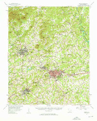
1957 Map of Easley
USGS Topo · Published 1958About this map
Easley, Pickens, and Liberty serve as the primary hubs of this mid-century Piedmont landscape, anchored by the Southern Railway corridor. The textile industry remains a visible driver of settlement, evidenced by the mill community of Ariail and several residential clusters surrounding the larger towns. Further north, the terrain transitions into a series of prominent peaks including Glassy Mtn, Cedar Rock Mtn, and Walnut Cove Mountain, with agricultural life centered around local landmarks like Dacusville and Cross Roads.
Find a feature on this map
139 named features on this map. Tap any name to fly to it.
Don’t see what you’re looking for? This feature index may not catch every label — zoom into the map to look around manually.
Map Details
Editions of this 1957 Easley Map
2 editions found
Other maps of this area

1888 · Pickens
USGS Topo · 1:125,000

1894 · Pickens
USGS Topo · 1:125,000

1905 · Pisgah
USGS Topo · 1:125,000

1906 · Pisgah
USGS Topo · 1:125,000

1907 · Saluda
USGS Topo · 1:125,000

1935 · Eastatoe Gap
USGS Topo · 1:24,000

1935 · Greenville
USGS Topo · 1:48,000

1935 · Table Rock
USGS Topo · 1:24,000

1938 · Greenville
USGS Topo · 1:62,500
1946 · Eastatoe Gap
USGS Topo · 1:24,000