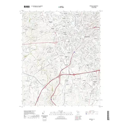
2020 Map of Greenville
USGS Topo · Published 2020About this map
The Greenville metropolitan landscape is defined by the winding course of the Reedy River and the industrial corridors of the P & N RR. This survey captures the city's extensive suburban footprint, from the historic core near the Greenville County Courthouse to established neighborhoods like Nicholtown, Overbrook, and City View. The map is particularly useful for genealogical research, documenting numerous burial grounds including the Christ Church Cem, Bethesda Baptist Cem, and Resthaven Memorial Gardens. To the west, the Saluda River forms a natural boundary, crossed by the Saluda Dam Bridge and Dunham Bridge. The transition from urban density to industrial sites like Woodside and Brandon reflects the area's textile heritage, while the southern reach includes the aviation grounds at Donaldson Field.
Find a feature on this map
64 named features on this map. Tap any name to fly to it.
Don’t see what you’re looking for? This feature index may not catch every label — zoom into the map to look around manually.
Map Details
Editions of this 2020 Greenville Map
This is the sole edition of this map. No revisions or reprints were ever made.
Other maps of this area

1888 · Pickens
USGS Topo · 1:125,000

1894 · Pickens
USGS Topo · 1:125,000

1935 · Greenville
USGS Topo · 1:48,000

1938 · Greenville
USGS Topo · 1:62,500

1954 · Greenville
USGS Topo · 1:250,000

1957 · Greenville
USGS Topo · 1:24,000

1957 · Anderson
USGS Topo · 1:62,500

1957 · Easley
USGS Topo · 1:62,500

1957 · Williamston
USGS Topo · 1:62,500

1957 · Greenville
USGS Topo · 1:62,500