
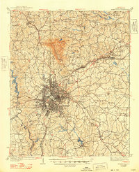
1938 Map of Greenville
USGS Topo · Published 1938About this map
Greenville serves as the hub of this 1930s textile and industrial landscape, with dense street grids radiating out toward satellite communities like West Greenville and Berea. The area’s growth is anchored by the Southern RR and the Northern Electric RR, which connect local industry to the wider Piedmont region. To the north, the prominent silhouette of Paris Mtn rises above the rolling terrain, while the Reedy River and Saluda River provided the essential water power that fueled the region's development, evidenced by the presence of Saluda Lake and Conestee Lake.
Find a feature on this map
119 named features on this map. Tap any name to fly to it.
Don’t see what you’re looking for? This feature index may not catch every label — zoom into the map to look around manually.
Map Details
Editions of this 1938 Greenville Map
2 editions found
Other maps of this area

1888 · Pickens
USGS Topo · 1:125,000

1894 · Pickens
USGS Topo · 1:125,000

1905 · Pisgah
USGS Topo · 1:125,000

1906 · Pisgah
USGS Topo · 1:125,000

1907 · Saluda
USGS Topo · 1:125,000

1935 · Greer
USGS Topo · 1:48,000

1935 · Greenville
USGS Topo · 1:48,000

1938 · Greer
USGS Topo · 1:62,500

1954 · Greenville
USGS Topo · 1:250,000

1955 · Knoxville
USGS Topo · 1:250,000