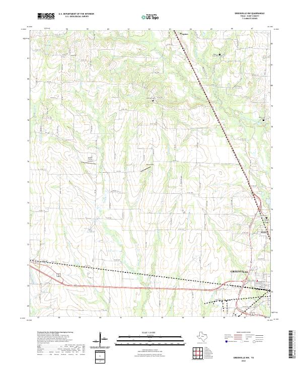
2022 Map of Greenville NW
USGS Topo · Published 2022About this map
Kingston and the northwestern outskirts of Greenville anchor this 2022 survey of Hunt County. The landscape is defined by the headwaters of the Cowleech Fork Sabine River, where numerous tributaries like Muriel Br and Holder Br drain the prairie terrain. For family historians, the map identifies several local burial sites, including McWright Cem, Morley Cem, and Barnhart Boles Cem.
Find a feature on this map
112 named features on this map. Tap any name to fly to it.
Don’t see what you’re looking for? This feature index may not catch every label — zoom into the map to look around manually.
Map Details
Editions of this 2022 Greenville NW Map
This is the sole edition of this map. No revisions or reprints were ever made.
Other maps of this area

1930 · Farmersville
USGS Topo · 1:62,500

1954 · Sherman
USGS Topo · 1:250,000

1958 · Sherman
USGS Topo · 1:250,000

1960 · Pike
USGS Topo · 1:24,000

1962 · Greenville NW
USGS Topo · 1:24,000

1962 · Greenville SW
USGS Topo · 1:24,000

1962 · Greenville SE
USGS Topo · 1:24,000

1962 · Farmersville
USGS Topo · 1:24,000

1963 · Greenville NE
USGS Topo · 1:24,000
1963 · Josephine
USGS Topo · 1:24,000