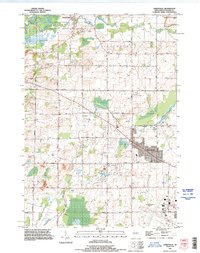
1992 Map of Greenville
USGS Topo · Published 1996About this map
The Wolf River and its associated wetlands dominate the northwestern corner of this landscape near Stephensville, while the southeastern corner reflects the burgeoning infrastructure of late-twentieth-century Greenville. The map illustrates a notable transition from the floodplain environment of the Rat River and Bear Creek to the established aviation facilities at the Outagamie County Airport.
Find a feature on this map
28 named features on this map. Tap any name to fly to it.
Don’t see what you’re looking for? This feature index may not catch every label — zoom into the map to look around manually.
Map Details
Editions of this 1992 Greenville Map
This is the sole edition of this map. No revisions or reprints were ever made.
Other maps of this area

1911 · Neenah
USGS Topo · 1:62,500

1955 · Neenah
USGS Topo · 1:62,500

1955 · Appleton
USGS Topo · 1:24,000

1955 · Appleton
USGS Topo · 1:62,500

1955 · Neenah
USGS Topo · 1:24,000

1955 · Green Bay
USGS Topo · 1:250,000

1956 · New London
USGS Topo · 1:48,000

1961 · Oshkosh
USGS Topo · 1:62,500

1961 · Oshkosh NE
USGS Topo · 1:24,000

1961 · Oshkosh NW
USGS Topo · 1:24,000