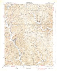
1939 Map of Greenville
USGS Topo · Published 1939About this map
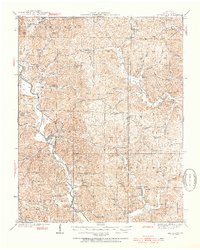
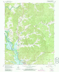
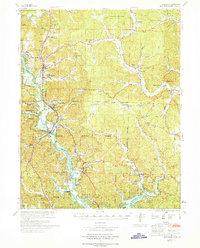
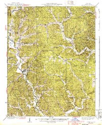
The St Francois River winds through the heart of Wayne County in this mid-1930s survey, serving as the primary geographic anchor for the county seat at Greenville. The landscape is defined by a dense network of hollows and creeks, such as McCarn Hollow and Bear Creek, where small agricultural and timber-related settlements like Silva, Hiram, and Burbank established themselves. This era represents a period of significant public works and rural development, evidenced by the presence of a CCC Camp and a prolific number of neighborhood schools like Oak Grove Sch and Turkey Cr Sch. The distribution of these schools and churches, including Reed Chapel and Wesley Chapel, reflects a decentralized community structure where local life centered around small creek-side hollows before the modernization of the Ozark region.
Find a feature on this map
80 named features on this map. Tap any name to fly to it.
Don’t see what you’re looking for? This feature index may not catch every label — zoom into the map to look around manually.
Map Details
Editions of this 1939 Greenville Map
2 editions found
Historical Maps of Greenville Through Time
8 maps found