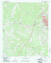
1971 Map of Greenville West
USGS Topo · Published 1986About this map
The city of Greenville serves as the focal point of this map, showing the town's expansion through purple-tinted updates that detail residential and institutional growth around Commerce St and Government St. Educational and community anchors like the Baptist Hill Sch, Jr High Sch, and the local Hosp provide a clear view of the mid-century municipal core. To the west, the landscape shifts toward the sprawling Butler County Wildlife Management Area, defined by the winding paths of Beaver Creek and Rocky Creek.
Find a feature on this map
50 named features on this map. Tap any name to fly to it.
Don’t see what you’re looking for? This feature index may not catch every label — zoom into the map to look around manually.
Map Details
Editions of this 1971 Greenville West Map
2 editions found
Other maps of this area

1953 · Andalusia
USGS Topo · 1:250,000

1957 · Andalusia
USGS Topo · 1:250,000

1971 · Greenville West
USGS Topo · 1:24,000

1971 · Pigeon Creek
USGS Topo · 1:24,000

1971 · Fort Deposit
USGS Topo · 1:24,000

1971 · Fort Dale
USGS Topo · 1:24,000

1971 · Greenville East
USGS Topo · 1:24,000

1971 · Georgiana East
USGS Topo · 1:24,000

1971 · Georgiana West
USGS Topo · 1:24,000

1981 · Forest Home
USGS Topo · 1:24,000