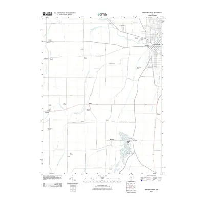
2010 Map of Greenville West
USGS Topo · Published 2010About this map
Greenville serves as the focal point for this western Ohio landscape, where the town's expansion meets a countryside defined by agricultural networks and historic family-named burial grounds. Significant local landmarks include the Darke County Fairgrounds and Tecumsehs Point, reflecting the region's cultural and historical heritage. To the south, the irregular water features of Wayne Lakes Park provide a distinct contrast to the straight-line drainage of Lake Branch Ditch and the winding course of Greenville Creek.
Find a feature on this map
74 named features on this map. Tap any name to fly to it.
Don’t see what you’re looking for? This feature index may not catch every label — zoom into the map to look around manually.
Map Details
Editions of this 2010 Greenville West Map
This is the sole edition of this map. No revisions or reprints were ever made.
Other maps of this area

1915 · New Paris
USGS Topo · 1:48,000

1916 · Winchester
USGS Topo · 1:48,000

1918 · Winchester
USGS Topo · 1:62,500

1918 · New Paris
USGS Topo · 1:62,500

1943 · Winchester
USGS Topo · 1:62,500

1953 · Cincinnati
USGS Topo · 1:250,000

1953 · Muncie
USGS Topo · 1:250,000

1956 · Muncie
USGS Topo · 1:250,000

1957 · Cincinnati
USGS Topo · 1:250,000

1960 · Union City
USGS Topo · 1:24,000