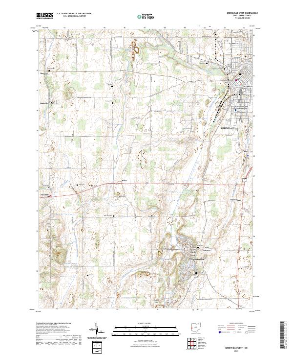
2023 Map of Greenville West
USGS Topo · Published 2023About this map
Greenville serves as the focal point of this western Darke County landscape, where the Darke County Courthouse stands near the historic confluence of Greenville Creek and Mud Creek. To the north, Tecumseh Point marks a site of significant regional importance, while the city is ringed by established grounds like Greenville Union Cem. The southern reaches of the map feature the distinct water-integrated community of Wayne Lakes and the adjacent Wayne Lakes Park, situated near the site of Fort Jefferson.
Find a feature on this map
123 named features on this map. Tap any name to fly to it.
Don’t see what you’re looking for? This feature index may not catch every label — zoom into the map to look around manually.
Map Details
Editions of this 2023 Greenville West Map
This is the sole edition of this map. No revisions or reprints were ever made.
Other maps of this area

1915 · New Paris
USGS Topo · 1:48,000

1916 · Winchester
USGS Topo · 1:48,000

1918 · Winchester
USGS Topo · 1:62,500

1918 · New Paris
USGS Topo · 1:62,500

1943 · Winchester
USGS Topo · 1:62,500

1953 · Cincinnati
USGS Topo · 1:250,000

1953 · Muncie
USGS Topo · 1:250,000

1956 · Muncie
USGS Topo · 1:250,000

1957 · Cincinnati
USGS Topo · 1:250,000

1960 · Union City
USGS Topo · 1:24,000