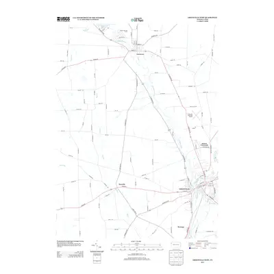
2013 Map of Greenville West
USGS Topo · Published 2013About this map
Greenville serves as the primary urban center in this 2013 survey of Mercer County, situated at the confluence of the Shenango River and the Little Shenango River. This landscape is defined by the waterways that carve through the region, including the northern reaches of the Pymatuning Reservoir near Jamestown. The map documents a blend of established municipal infrastructure and rural road networks that connect smaller settlements like Maysville and Donner Crossroads.
Find a feature on this map
101 named features on this map. Tap any name to fly to it.
Don’t see what you’re looking for? This feature index may not catch every label — zoom into the map to look around manually.
Map Details
Editions of this 2013 Greenville West Map
This is the sole edition of this map. No revisions or reprints were ever made.
Other maps of this area

1905 · Andover
USGS Topo · 1:48,000

1906 · Linesville
USGS Topo · 1:62,500

1907 · Andover
USGS Topo · 1:62,500

1907 · Kinsman
USGS Topo · 1:62,500

1908 · Shenango
USGS Topo · 1:62,500

1908 · Linesville
USGS Topo · 1:62,500

1950 · Cleveland
USGS Topo · 1:250,000

1956 · Cleveland
USGS Topo · 1:250,000

1958 · Sharpsville
USGS Topo · 1:24,000

1958 · Greensville West
USGS Topo · 1:24,000
Featured Places
- Greenville, PA
- Shenango, West Salem Township
- Jamestown, PA
- West Salem Township, PA
- South Shenango Township, PA