
1908 Map of Linesville
USGS Topo · Published 1908About this map
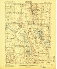
Conneaut Lake serves as a central landmark in this 1908 Crawford County survey, revealing a landscape defined by its wetland networks and early rail infrastructure. The lake is notable for its marked Steamboat Route and the lakeside development at Exposition Park, signaling its role as a regional destination. To the west, the extensive Pymatuning Swamp dominates the terrain before its mid-century transformation, with the Shenango River threading through the lowlands.
Find a feature on this map
94 named features on this map. Tap any name to fly to it.
Don’t see what you’re looking for? This feature index may not catch every label — zoom into the map to look around manually.
Map Details
Editions of this 1908 Linesville Map
4 editions found
Other maps of this area

1900 · Girard
USGS Topo · 1:62,500

1905 · Andover
USGS Topo · 1:48,000

1906 · Conneaut
USGS Topo · 1:62,500

1906 · Linesville
USGS Topo · 1:62,500

1907 · Andover
USGS Topo · 1:62,500

1907 · Kinsman
USGS Topo · 1:62,500

1908 · Shenango
USGS Topo · 1:62,500

1911 · Stoneboro
USGS Topo · 1:62,500

1913 · Stoneboro
USGS Topo · 1:62,500

1923 · Meadville
USGS Topo · 1:62,500
Featured Places
- Linesville, PA
- Conneaut Lake, PA
- Summerhill Township, PA
- Pymatuning Central, PA
- West Fallowfield Township, PA