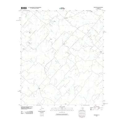
2010 Map of Greenvine
USGS Topo · Published 2010About this map
The agrarian hamlets of Latium and Greenvine anchor this landscape in Washington County, defined by a dense network of country roads and family-named landmarks. The map documents a deeply rooted community where local history is preserved in sites such as the Jaeger-Witte Cemetery, Mayer Cemetery, and Schmidt Cemetery. This 2010 snapshot of the region shows how the drainage patterns of West Mill Creek and Brushy Creek influenced the placement of early homesteads and farm-to-market routes. Small-scale water features like Loftin Lake and its corresponding Loftin Lake Dam punctuate the terrain near Wickel Rd, while the eastern reaches near Wesley are defined by the winding paths of Sandy Branch and Dogwood Creek. The layout of roads like Latium Cemetery Rd and Sacred Heart Rd illustrates the historical connection between these rural centers and their communal gathering places.
Find a feature on this map
41 named features on this map. Tap any name to fly to it.
Don’t see what you’re looking for? This feature index may not catch every label — zoom into the map to look around manually.
Map Details
Editions of this 2010 Greenvine Map
This is the sole edition of this map. No revisions or reprints were ever made.
Other maps of this area

1919 · Fayettsville
USGS Topo · 1:62,500

1930 · Brenham
USGS Topo · 1:62,500

1953 · Seguin
USGS Topo · 1:250,000

1954 · Austin
USGS Topo · 1:250,000

1956 · Bellville
USGS Topo · 1:62,500

1956 · Brenham
USGS Topo · 1:62,500

1958 · Seguin
USGS Topo · 1:250,000

1958 · Industry
USGS Topo · 1:24,000

1958 · Greenvine
USGS Topo · 1:24,000

1958 · Carmine
USGS Topo · 1:24,000