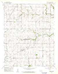
1960 Map of Greenwich
USGS Topo · Published 1961About this map
The Greenwich settlement serves as the central hub of this 1960 survey, situated where the Missouri Pacific railroad cuts through the prairie of eastern Sedgwick County. The landscape is defined by its agricultural and early industrial transition, featuring numerous oil wells and a larger oil field scattered across the township of Payne. A notable historical landmark is the Old Indian Boundary line, which runs east-west across the lower third of the quadrangle, reflecting older land divisions that persist in the modern section-line road system.
Find a feature on this map
26 named features on this map. Tap any name to fly to it.
Don’t see what you’re looking for? This feature index may not catch every label — zoom into the map to look around manually.
Map Details
Editions of this 1960 Greenwich Map
3 editions found
Other maps of this area

1889 · Wichita
USGS Topo · 1:125,000

1894 · Wichita
USGS Topo · 1:125,000

1941 · Valley Center
USGS Topo · 1:31,680

1942 · Valley Center
USGS Topo · 1:31,680

1943 · Wichita East
USGS Topo · 1:31,680

1945 · Andover
USGS Topo · 1:31,680

1955 · Santa Fe Lake
USGS Topo · 1:24,000

1955 · Benton
USGS Topo · 1:24,000

1955 · Greenwich
USGS Topo · 1:24,000

1955 · Wichita
USGS Topo · 1:250,000