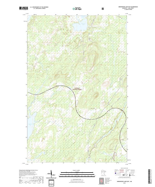
2022 Map of Greenwood Lake East
USGS Topo · Published 2022About this map
Superior National Forest defines the landscape of this Lake County region, where a dense network of waterways feeds the iconic Arrowhead wilderness. The Stony River and Greenwood River are central to the local hydrology, joined by smaller tributaries like Stockade Cr and Mary Ann Cr. This 2022 survey illustrates a terrain primarily characterized by wetlands and timber, with significant water bodies including McDougal Lakes and the northern reaches of Greenwood Lake. The transportation network is sparse, reflecting the preservation-focused management of the forest, though historically significant routes like the Stoney River Grade and McDougal Lake Road provide the primary access through the townships. Researchers can observe the intricate wetland boundaries and drainage patterns into Spur End Cr and Coyote Cr, which have shaped the local ecology and human access for generations.
Find a feature on this map
19 named features on this map. Tap any name to fly to it.
Don’t see what you’re looking for? This feature index may not catch every label — zoom into the map to look around manually.
Map Details
Editions of this 2022 Greenwood Lake East Map
This is the sole edition of this map. No revisions or reprints were ever made.
Other maps of this area

1953 · Whyte
USGS Topo · 1:62,500

1954 · Greenwood Lake
USGS Topo · 1:62,500

1954 · Silver Bay
USGS Topo · 1:62,500

1954 · Two Harbors
USGS Topo · 1:250,000

1955 · Isabella
USGS Topo · 1:62,500

1957 · Two Harbors
USGS Topo · 1:250,000

1958 · Two Harbors
USGS Topo · 1:250,000

1964 · Two Harbors
USGS Topo · 1:250,000

1976 · Two Harbors
USGS Topo · 1:100,000
1981 · Slate Lake West
USGS Topo · 1:24,000