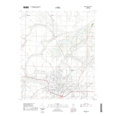
2018 Map of Greenwood
USGS Topo · Published 2018About this map
Greenwood serves as the focal point of this Mississippi Delta landscape, situated at the confluence of the Tallahatchie River and the Yalobusha River, which join here to form the Yazoo River. The map documents the city's modern street grid and its connection to outlying areas like Grenada Junction and Wakeland. For genealogists, the survey is particularly detailed regarding burial sites, noting several significant locations such as Old Greenwood Cem, Magnolia Cem, and rural spots like Little Zion Cem and Saint Mark Cem. The surrounding terrain is defined by its complex hydrology, featuring numerous oxbows and waterways including Old Orchard Lake, Two Mile Lake, and the Big Sand Creek Cutoff. The map also captures the industrial and agricultural infrastructure of the region, from the Walker Lake Canal to the various county roads that thread through the delta lowlands.
Find a feature on this map
162 named features on this map. Tap any name to fly to it.
Don’t see what you’re looking for? This feature index may not catch every label — zoom into the map to look around manually.
Map Details
Editions of this 2018 Greenwood Map
This is the sole edition of this map. No revisions or reprints were ever made.
Other maps of this area

1931 · Schlater
USGS Topo · 1:48,000

1934 · Schlater
USGS Topo · 1:62,500

1936 · Greenwood
USGS Topo · 1:62,500

1939 · Schlater
USGS Topo · 1:62,500

1940 · Seven Pines
USGS Topo · 1:62,500

1940 · Greenwood
USGS Topo · 1:62,500

1953 · Greenwood
USGS Topo · 1:250,000

1956 · Greenwood
USGS Topo · 1:250,000

1957 · Greenwood
USGS Topo · 1:62,500

1957 · Seven Pines
USGS Topo · 1:62,500