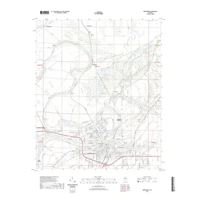
2020 Map of Greenwood
USGS Topo · Published 2020About this map
Greenwood serves as the focal point of this Mississippi Delta landscape, situated at the confluence where the Tallahatchie River and the Yalobusha River join to form the Yazoo River. The city's civic heart is anchored by the Leflore County Courthouse, surrounded by a dense network of streets that give way to the expansive wetlands and agricultural tracts characteristic of the region. Notable water features like Hells Halfacre, Mossy Lakes, and the Big Sand Creek Cutoff illustrate the complex hydrology of the low-lying plains. Several historic burial sites, including Old Greenwood Cem and Little Zion Cem, are scattered throughout the rural outskirts and city blocks, providing vital touchpoints for genealogical research. Smaller outlying settlements such as Fort Loring, Wildwood, and Craigside dot the perimeter, connected by a web of rural routes like Money Rd that trace the meanders of the river systems.
Find a feature on this map
163 named features on this map. Tap any name to fly to it.
Don’t see what you’re looking for? This feature index may not catch every label — zoom into the map to look around manually.
Map Details
Editions of this 2020 Greenwood Map
This is the sole edition of this map. No revisions or reprints were ever made.
Other maps of this area

1931 · Schlater
USGS Topo · 1:48,000

1934 · Schlater
USGS Topo · 1:62,500

1936 · Greenwood
USGS Topo · 1:62,500

1939 · Schlater
USGS Topo · 1:62,500

1940 · Seven Pines
USGS Topo · 1:62,500

1940 · Greenwood
USGS Topo · 1:62,500

1953 · Greenwood
USGS Topo · 1:250,000

1956 · Greenwood
USGS Topo · 1:250,000

1957 · Greenwood
USGS Topo · 1:62,500

1957 · Seven Pines
USGS Topo · 1:62,500