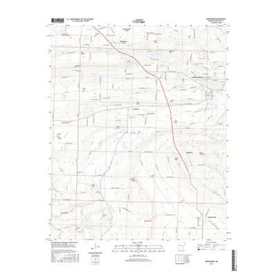
2017 Map of Greenwood
USGS Topo · Published 2017About this map
Greenwood serves as the central hub of this Sebastian County landscape, surrounded by a complex network of ridges and minor peaks. The terrain is defined by prominent elevations such as Backbone Mtn and Devils Backbone Ridge, which influence the local drainage patterns of Hester Cr and Heartsill Cr. The map reveals a high concentration of small rural burial grounds, including the Douglass Cem and Lovelace Cem, indicating a long history of family settlements scattered between the larger communities of New Jenny Lind and Witcherville. Water resources are focused around Shadow Lake and Greenwood Lake, while the local geography is further marked by numerous family-named landmarks like Skinner Hill and Griffith Mtn. This layout illustrates a transition from the structured street grid of the county seat to the dispersed agricultural and residential tracts of the surrounding Arkansas hills.
Find a feature on this map
156 named features on this map. Tap any name to fly to it.
Don’t see what you’re looking for? This feature index may not catch every label — zoom into the map to look around manually.
Map Details
Editions of this 2017 Greenwood Map
This is the sole edition of this map. No revisions or reprints were ever made.
Other maps of this area

1879 · Fort Smith
USGS Topo · 1:62,500

1887 · Van Buren
USGS Topo · 1:62,500

1887 · Greenwood
USGS Topo · 1:62,500

1890 · Fort Smith
USGS Topo · 1:125,000

1906 · Lavaca
USGS Topo · 1:62,500

1906 · Barber
USGS Topo · 1:62,500

1943 · Fort Smith
USGS Topo · 1:125,000

1946 · Fort Smith
USGS Topo · 1:250,000

1947 · Lavaca
USGS Topo · 1:62,500

1947 · Van Buren
USGS Topo · 1:62,500