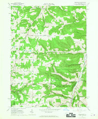
1965 Map of Greenwood
USGS Topo · Published 1967About this map
The hills of the Allegany and Steuben County border are defined here by a network of steep hollows and upland ridges during the mid-1960s. The settlement of Greenwood sits in the valley at the junction of Bennetts Creek and Rock Creek, while smaller hamlets like Hartsville and West Greenwood occupy the surrounding terrain. This landscape reflects a mix of traditional agriculture and emerging resource extraction, with numerous Oil Wells and a Compressor Station located southwest of the main town. Large swaths of the area are designated as the State Reforestation Area, indicating a shift in land use toward conservation on steeper slopes like Purdy Hill and Call Hill. Genealogists will find a wealth of family history data preserved in the local burial grounds, including the Gull Hill Cem, Slaight Cem, and Dryden Cem.
Find a feature on this map
54 named features on this map. Tap any name to fly to it.
Don’t see what you’re looking for? This feature index may not catch every label — zoom into the map to look around manually.
Map Details
Editions of this 1965 Greenwood Map
2 editions found
Other maps of this area

1915 · Hornell
USGS Topo · 1:62,500

1916 · Canaseraga
USGS Topo · 1:62,500

1918 · Hornell
USGS Topo · 1:62,500

1926 · Wellsville
USGS Topo · 1:62,500

1926 · Greenwood
USGS Topo · 1:62,500

1940 · Canaseraga
USGS Topo · 1:62,500

1950 · Elmira
USGS Topo · 1:250,000

1954 · South Canisteo
USGS Topo · 1:24,000

1954 · Troupsburg
USGS Topo · 1:24,000
1954 · Canisteo
USGS Topo · 1:24,000