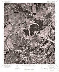
1974 Map of Greenwood SW
USGS Topo · Published 1975About this map
Greenwood sits at the heart of this orthophotomap, showing the concentrated urban development and residential grids surrounded by the sweeping meanders of the Yazoo River basin in the mid-1970s. The aerial imagery highlights the sharp contrast between the dense street network of the city and the vast, patterned agricultural fields that dominate the surrounding Delta landscape. The winding river channels and oxbow-like formations visible from this 1974 perspective reveal how water has historically shaped the layout of the town and its outskirts. This photographic study provides a clear look at the infrastructure of the era, from the industrial sites along the riverbanks to the major roadway corridors connecting the community to the wider region.
Find a feature on this map
1 named feature on this map. Tap any name to fly to it.
Don’t see what you’re looking for? This feature index may not catch every label — zoom into the map to look around manually.
Map Details
Editions of this 1974 Greenwood SW Map
This is the sole edition of this map. No revisions or reprints were ever made.
Other maps of this area

1931 · Schlater
USGS Topo · 1:48,000

1934 · Schlater
USGS Topo · 1:62,500

1936 · Greenwood
USGS Topo · 1:62,500

1939 · Schlater
USGS Topo · 1:62,500

1940 · Seven Pines
USGS Topo · 1:62,500

1940 · Greenwood
USGS Topo · 1:62,500

1953 · Greenwood
USGS Topo · 1:250,000

1956 · Greenwood
USGS Topo · 1:250,000

1957 · Greenwood
USGS Topo · 1:62,500

1957 · Seven Pines
USGS Topo · 1:62,500