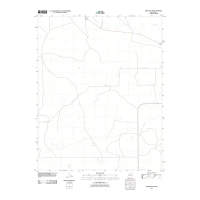
2010 Map of Grenville SW
USGS Topo · Published 2010About this map
Seneca Creek winds through the northern portion of this High Plains landscape in northeastern New Mexico, defining one of the few natural breaks in an otherwise open, high-altitude terrain. The area reflects a sparse, ranching-oriented settlement pattern typical of Union County, where the vastness of the land is structured by a grid of rural routes rather than dense population centers. Movement through the territory is facilitated by local connectors like County Hwy A-012 and County Hwy A-052, which provide essential links across the prairie. This 2010 survey illustrates a quiet corner of the state where the historical reliance on intermittent water sources and wide-open grazing land remains the dominant geographic theme.
Find a feature on this map
3 named features on this map. Tap any name to fly to it.
Don’t see what you’re looking for? This feature index may not catch every label — zoom into the map to look around manually.
Map Details
Editions of this 2010 Grenville SW Map
This is the sole edition of this map. No revisions or reprints were ever made.
Other maps of this area

1954 · Dalhart
USGS Topo · 1:250,000

1958 · Dalhart
USGS Topo · 1:250,000

1962 · Dalhart
USGS Topo · 1:250,000

1972 · Little Grande
USGS Topo · 1:24,000

1972 · Cow Mountain
USGS Topo · 1:24,000
1973 · Wetherly Lake
USGS Topo · 1:24,000

1973 · Grenville SW
USGS Topo · 1:24,000

1973 · Snyder Lake
USGS Topo · 1:24,000

1973 · Tripod Mountain
USGS Topo · 1:24,000
1973 · Blind Gap
USGS Topo · 1:24,000