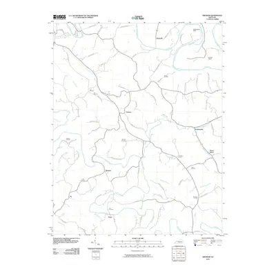
2010 Map of Gresham
USGS Topo · Published 2010About this map
The Green River carves a winding path through this corner of Green County, creating distinct geographic features like Penitentiary Bend and Lemon Bend in the northern reaches. This landscape is defined by the dendritic drainage patterns of Russell Creek and its many tributaries, including South Fork Russell Creek and Sulphur Fork. The settlement pattern is largely dispersed, with small communities such as Gresham, Roachville, and Haskingsville serving as focal points for a network of rural roads named for local families.
Find a feature on this map
71 named features on this map. Tap any name to fly to it.
Don’t see what you’re looking for? This feature index may not catch every label — zoom into the map to look around manually.
Map Details
Editions of this 2010 Gresham Map
This is the sole edition of this map. No revisions or reprints were ever made.
Other maps of this area

1953 · Gradyville
USGS Topo · 1:24,000

1953 · Campbellsville
USGS Topo · 1:24,000

1953 · Summersville
USGS Topo · 1:24,000

1953 · Exie
USGS Topo · 1:24,000

1953 · Gresham
USGS Topo · 1:24,000

1953 · East Fork
USGS Topo · 1:24,000

1953 · Cane Valley
USGS Topo · 1:24,000

1954 · Columbia
USGS Topo · 1:24,000

1954 · Greensburg
USGS Topo · 1:24,000

1957 · Winchester
USGS Topo · 1:250,000