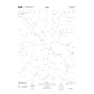
2013 Map of Gresham
USGS Topo · Published 2013About this map
Green River meanders through the heart of Green County, forming dramatic oxbows such as Penitentiary Bend, Tibbs Bend, and Lemon Bend. This agricultural landscape is defined by the winding paths of Russell Creek and its many tributaries, including South Fork Russell Creek and Sulphur Fork Creek. The area is dotted with small rural settlements like Gresham, Bramlett, and Roachville, which serve as nodes in a network of family-named roads and country lanes. Genealogists will find a wealth of local history in the numerous burial grounds scattered throughout the quadrangle, from the Hancock Cemetery near the center to the Wilson Cemetery and Thompson Cemetery. The map captures the quiet, dispersed nature of this Kentucky community, where the land is deeply tied to the waterways and local lineage remains visible in the landscape names.
Find a feature on this map
123 named features on this map. Tap any name to fly to it.
Don’t see what you’re looking for? This feature index may not catch every label — zoom into the map to look around manually.
Map Details
Editions of this 2013 Gresham Map
This is the sole edition of this map. No revisions or reprints were ever made.
Other maps of this area

1953 · Gradyville
USGS Topo · 1:24,000

1953 · Campbellsville
USGS Topo · 1:24,000

1953 · Summersville
USGS Topo · 1:24,000

1953 · Exie
USGS Topo · 1:24,000

1953 · Gresham
USGS Topo · 1:24,000

1953 · East Fork
USGS Topo · 1:24,000

1953 · Cane Valley
USGS Topo · 1:24,000

1954 · Columbia
USGS Topo · 1:24,000

1954 · Greensburg
USGS Topo · 1:24,000

1957 · Winchester
USGS Topo · 1:250,000