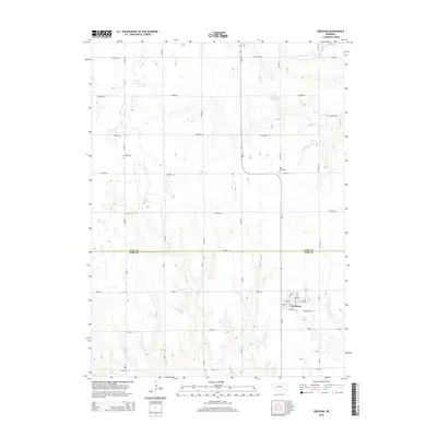
2014 Map of Gresham
USGS Topo · Published 2014About this map
Gresham serves as the primary hub of this eastern Nebraska landscape, situated near the intersection of the Polk and York county line. The town's grid is clearly defined by residential streets such as Cherry St, Pine St, and Beech St, which cluster around the village center. A series of water management features define the surrounding agricultural territory, including Torell Reservoir, Miller Reservoir, and Hopwood Reservoir. These man-made impoundments, alongside the Big Blue River in the northeast, reflect the critical role of water conservation in the Great Plains' farming economy. Genealogists will find several local burial grounds documented on this 2014 survey, including Cedar Lawn Cem on the town's eastern edge, and the rural Blue Ridge Cem and Hoffer Cem further north. This map illustrates the transition from organized town life to the expansive section-line road network that governs the Nebraska countryside.
Find a feature on this map
36 named features on this map. Tap any name to fly to it.
Don’t see what you’re looking for? This feature index may not catch every label — zoom into the map to look around manually.
Map Details
Editions of this 2014 Gresham Map
This is the sole edition of this map. No revisions or reprints were ever made.
Other maps of this area

1896 · Stromsburg
USGS Topo · 1:125,000

1898 · York
USGS Topo · 1:125,000

1899 · David City
USGS Topo · 1:125,000

1899 · York
USGS Topo · 1:125,000

1934 · Utica
USGS Topo · 1:62,500

1937 · Utica
USGS Topo · 1:62,500

1955 · Fremont
USGS Topo · 1:250,000

1955 · Lincoln
USGS Topo · 1:250,000

1957 · Fremont
USGS Topo · 1:250,000

1957 · Lincoln
USGS Topo · 1:250,000