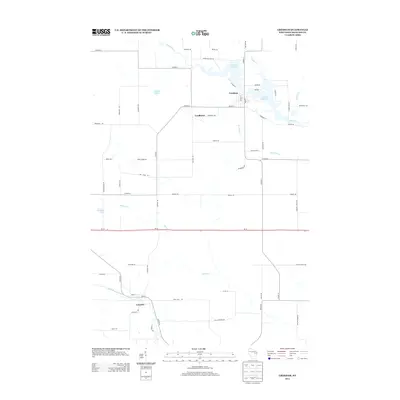
2013 Map of Gresham
USGS Topo · Published 2013About this map
Gresham and the surrounding Shawano County landscape are defined by the winding course of the Red River, which expands into Upper Red Lake and Lower Red Lake at the northern edge of this study. The village layout shows a network of local streets like Main St and W River St positioned near the water's edge, while the southern portion of the area transitions into the smaller settlements of Lyndhurst and Leopolis. These communities are connected by rural routes such as Co HWY-A and Co HWY-G that cut through a landscape dotted with smaller water bodies including Smith Lake and Kroening Lake. To the south, the North Branch Embarrass River meanders across the terrain, joined by several local tributaries like Spencer Cr and Kroenke Cr. This network of streams and creeks reflects a long-standing dependence on the local watershed for both settlement placement and agricultural boundary lines in central Wisconsin.
Find a feature on this map
63 named features on this map. Tap any name to fly to it.
Don’t see what you’re looking for? This feature index may not catch every label — zoom into the map to look around manually.
Map Details
Editions of this 2013 Gresham Map
This is the sole edition of this map. No revisions or reprints were ever made.
Other maps of this area

1954 · Gresham
USGS Topo · 1:48,000

1954 · Shawano
USGS Topo · 1:48,000

1955 · Embarrass
USGS Topo · 1:48,000

1955 · Clintonville
USGS Topo · 1:48,000

1955 · Green Bay
USGS Topo · 1:250,000

1964 · Shawano
USGS Topo · 1:62,500

1964 · Gresham
USGS Topo · 1:62,500

1969 · Embarrass
USGS Topo · 1:24,000

1970 · Clintonville North
USGS Topo · 1:24,000
1970 · Marion
USGS Topo · 1:24,000