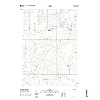
2018 Map of Gresham
USGS Topo · Published 2018About this map
Leopolis and the surrounding Shawano County countryside are defined by a intricate network of waterways and rural burial grounds. The North Branch Embarrass River winds through the southern portion of the quadrangle, while the northern terrain is marked by the Red River and a chain of bodies of water including Upper Red Lake and Lower Red Lake. This landscape reflects a long history of community settlement, visible through the numerous parish and family cemeteries such as Saint Johns Hermansfort Cem and Saint Francis Solanus Cem. The small settlements of Lyndhurst and Gresham serve as local hubs, connected by a grid of farm-to-market roads like Co Rd G and Roosevelt Rd that traverse the wetlands and wooded tracts.
Find a feature on this map
78 named features on this map. Tap any name to fly to it.
Don’t see what you’re looking for? This feature index may not catch every label — zoom into the map to look around manually.
Map Details
Editions of this 2018 Gresham Map
This is the sole edition of this map. No revisions or reprints were ever made.
Other maps of this area

1954 · Gresham
USGS Topo · 1:48,000

1954 · Shawano
USGS Topo · 1:48,000

1955 · Embarrass
USGS Topo · 1:48,000

1955 · Clintonville
USGS Topo · 1:48,000

1955 · Green Bay
USGS Topo · 1:250,000

1964 · Shawano
USGS Topo · 1:62,500

1964 · Gresham
USGS Topo · 1:62,500

1969 · Embarrass
USGS Topo · 1:24,000

1970 · Clintonville North
USGS Topo · 1:24,000
1970 · Marion
USGS Topo · 1:24,000