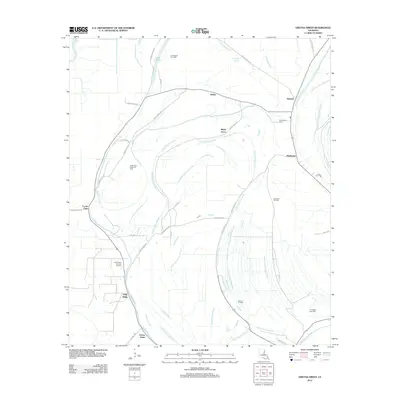
2012 Map of Gretna Green
USGS Topo · Published 2012About this map
Justina and Shady Grove anchor this 2012 landscape in Tensas Parish, where the geography is defined by a dense network of slow-moving waterways and active energy extraction. The area is intersected by Little Choctaw Bayou and Muddy Bayou, which meander through a region heavily utilized for its natural resources. Multiple active zones, including the North Holly Ridge Oil Field and Hard Bargin Gas Field, illustrate the industrial character of the parish at the start of the 21st century. Along the western edge, the Tensas River and Cooter Point mark significant terrain features, while local history is preserved at the Mayflower Cem near the settlement of Mayflower. The map also captures smaller communities like Gretna Green and Holly Ridge, connected by a web of parish roads that navigate the complex drainage patterns of the Louisiana bottomlands.
Find a feature on this map
34 named features on this map. Tap any name to fly to it.
Don’t see what you’re looking for? This feature index may not catch every label — zoom into the map to look around manually.
Map Details
Editions of this 2012 Gretna Green Map
This is the sole edition of this map. No revisions or reprints were ever made.
Other maps of this area

1909 · Delta Bridge
USGS Topo · 1:24,000

1935 · Winnsboro
USGS Topo · 1:62,500

1935 · Shackleford Lake
USGS Topo · 1:62,500

1939 · Locust Ridge
USGS Topo · 1:62,500

1941 · Sicily Island
USGS Topo · 1:62,500

1953 · Natchez
USGS Topo · 1:250,000

1955 · Jackson
USGS Topo · 1:250,000

1956 · Natchez
USGS Topo · 1:250,000

1957 · Sicily Island
USGS Topo · 1:62,500

1958 · Shackleford Lake
USGS Topo · 1:62,500