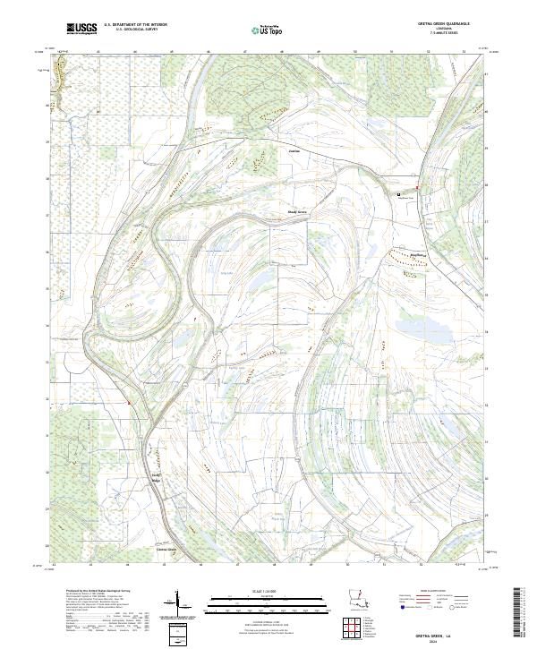
2024 Map of Gretna Green
USGS Topo · Published 2024About this map
The Tensas River lowlands of Louisiana define this 2024 survey, revealing a landscape deeply interconnected with its bayous and oxbow lakes. Small rural settlements like Gretna Green and Holly Ridge anchor the southern portion of the sheet, while Justina and Shady Grove are situated further north along the local road network. The map detail highlights the complex hydrology of the region, where Little Choctaw Bayou, Muddy Bayou, and Dickard Bayou wind through the terrain, feeding into numerous water bodies such as Turkey Lake and Wilson Lake. This network suggests a history tied to seasonal water levels and the fertile alluvial soil of the parish.
Find a feature on this map
50 named features on this map. Tap any name to fly to it.
Don’t see what you’re looking for? This feature index may not catch every label — zoom into the map to look around manually.
Map Details
Editions of this 2024 Gretna Green Map
This is the sole edition of this map. No revisions or reprints were ever made.
Other maps of this area

1909 · Delta Bridge
USGS Topo · 1:24,000

1935 · Winnsboro
USGS Topo · 1:62,500

1935 · Shackleford Lake
USGS Topo · 1:62,500

1939 · Locust Ridge
USGS Topo · 1:62,500

1941 · Sicily Island
USGS Topo · 1:62,500

1953 · Natchez
USGS Topo · 1:250,000

1955 · Jackson
USGS Topo · 1:250,000

1956 · Natchez
USGS Topo · 1:250,000

1957 · Sicily Island
USGS Topo · 1:62,500

1958 · Shackleford Lake
USGS Topo · 1:62,500