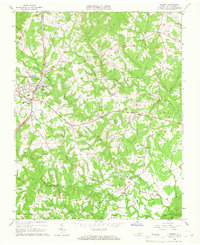
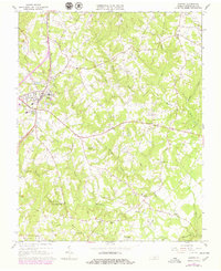
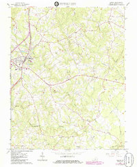
1965 Map of Gretna
USGS Topo · Published 1966About this map
Gretna serves as the primary hub of this Pittsylvania County landscape, situated along the Southern railroad line and U.S. 29. The map documents a mid-century rural economy where local milling operations like Vadens Mill and the Gretna Rolling Mill remained significant landmarks alongside the newer industrial presence of Pipelines and the Radio Towers (WMNA). Small agrarian communities and crossroads such as Chalk Level, Greenfield, and Sonans are scattered throughout the territory, often centered around local institutions like Sonans Sch or Midway Ch.
Find a feature on this map
38 named features on this map. Tap any name to fly to it.
Don’t see what you’re looking for? This feature index may not catch every label — zoom into the map to look around manually.
Map Details
Editions of this 1965 Gretna Map
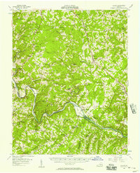
Other maps of this area

1892 · Lynchburg
USGS Topo · 1:125,000

1921 · Chatham
USGS Topo · 1:48,000

1923 · Chatham
USGS Topo · 1:62,500

1947 · Roanoke
USGS Topo · 1:250,000

1951 · Altavista
USGS Topo · 1:62,500

1953 · Greensboro
USGS Topo · 1:250,000

1954 · Greensboro
USGS Topo · 1:250,000

1954 · Riceville
USGS Topo · 1:62,500
1956 · Gladys
USGS Topo · 1:62,500

1959 · Roanoke
USGS Topo · 1:250,000