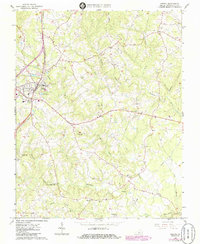
1965 Map of Gretna
USGS Topo · Published 1986About this map
The town of Gretna serves as the focal point of this mid-1960s landscape, situated along the Southern railroad line and acting as a hub for the surrounding rural communities. The map reveals a diversified local economy where early milling traditions intersect with modern infrastructure, evidenced by the Gretna Rolling Mill and Vadens Mill alongside newer developments like the Radio Towers (WMNA) and a Sewage Disposal Pond.
Find a feature on this map
39 named features on this map. Tap any name to fly to it.
Don’t see what you’re looking for? This feature index may not catch every label — zoom into the map to look around manually.
Map Details
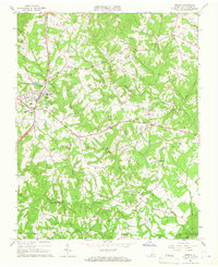
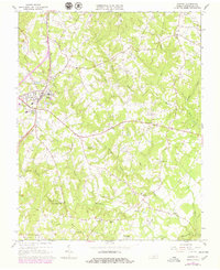
Editions of this 1965 Gretna Map
Other maps of this area

1892 · Lynchburg
USGS Topo · 1:125,000

1921 · Chatham
USGS Topo · 1:48,000

1923 · Chatham
USGS Topo · 1:62,500

1947 · Roanoke
USGS Topo · 1:250,000

1951 · Altavista
USGS Topo · 1:62,500

1953 · Greensboro
USGS Topo · 1:250,000

1954 · Greensboro
USGS Topo · 1:250,000

1954 · Riceville
USGS Topo · 1:62,500
1956 · Gladys
USGS Topo · 1:62,500

1959 · Roanoke
USGS Topo · 1:250,000