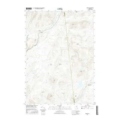
2016 Map of Griffin
USGS Topo · Published 2016About this map
The East Branch Sacandaga River cuts through this high-elevation terrain on the border of Hamilton and Warren counties. The small settlement of Griffin sits along Teachout Rd, where the river makes a sharp bend near Auger Falls. This landscape is defined by its complex hydrology, featuring numerous high-country vlys and ponds, such as Masher Vly, East Vly, and the secluded Shiras Pond.
Find a feature on this map
44 named features on this map. Tap any name to fly to it.
Don’t see what you’re looking for? This feature index may not catch every label — zoom into the map to look around manually.
Map Details
Editions of this 2016 Griffin Map
This is the sole edition of this map. No revisions or reprints were ever made.
Other maps of this area

1898 · Thirteenth Lake
USGS Topo · 1:62,500

1899 · Indian Lake
USGS Topo · 1:62,500

1902 · Indian Lake
USGS Topo · 1:62,500

1907 · Lake Pleasant
USGS Topo · 1:62,500

1910 · Stony Creek
USGS Topo · 1:62,500

1950 · Utica
USGS Topo · 1:250,000

1954 · Lake Pleasant
USGS Topo · 1:62,500

1954 · Thirteenth Lake
USGS Topo · 1:62,500

1954 · Indian Lake
USGS Topo · 1:62,500

1954 · Harrisburg
USGS Topo · 1:62,500